Foyle Civic Trust

Creating a sense of place

  • Home
  • About Us
  • Projects
  • Events
    • Upcoming Events
    • Events Archive
  • Membership
  • Publications
  • News
  • Contact

2013 City of Culture Project

Places (namesakes) around the world which share the name of Derry/Londonderry were used as a way of increasing the understanding of the international links created through history and to rekindle the relationship between these places during the UK City of Culture Year 2013.  Particular emphasis was placed on the development of an existing relationship with Derry/Londonderry in New Hampshire, USA, founded circa 1800 by a group of Ulster-Scots, led by Rev McGregor from Aghadowey, east County Londonderry, Northern Ireland.

The various elements to the project comprised:

  • A one-day conference at the Playhouse Theatre, 10 July 2013 – ‘An Examination of Emigration and Diaspora from the Maiden City and North-West Ulster’

Conference Programme

Conference-1
Conference-2
Conference-3
Conference-5
Conference-6
Conference-7
Conference-8
Conference-9
Conference-10
derrygoesglobalposter
  • A movable exhibition presenting information about the namesakes around the world.

Introduction

Cape Londonderry, Western Australia

Caribbean Islands

Derry, Pennsylvania, USA

Londonderry Island, Chile

Londonderry, Coolgardie, Western Australia

Londonderry, New Brunswick, Canada

Londonderry, Nova Scotia, Canada

Londonderry, New Hampshire, USA

Rev James McGregor, New Hampshire

Three towns – Londonderry, Derry, Windham

  • A companion publication to the exhibition – Directory of the Derrys and Londonderrys Around the World
  • A Schools Project connecting St Mary’s College and Foyle College Junior School in Derry~Londonderry with Londonderry High School and Middle School in New Hampshire.

Schools Banner

Schools Project Outline

  • The publication of a Heritage Guide ‘Twixt Foyle and Bann – an exploration of five heritage areas.

Twixt Foyle & Bann Publication

Twixt Foyle & Bann invite

photo-1
photo-2

Dunnalong Dig & Book Launch

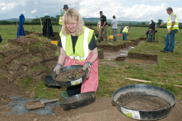
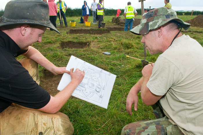
In partnership with NIEA, Derry City Council, Strabane District Council, the Centre for Maritime Archaeology at the University of Ulster, the Centre for Archaeological Fieldwork at QUB and the local landowner.  In August 2012 some 120 members of the public volunteered on the dig and many others visited the site and attended an open day in Bready.  A book on the community archaeological project was published, The Lost Settlement of Dunnalong, as a resource for the wider community.

Dunnalong Dig

Dunnalongdig1408122 Dunnalongdig1408124 Dunnalongdig1408127

Book Launch

2613-005-Dunnalong-book-launch

2613-009-Dunnalong-book-launch

2613-001-Dunnalong-book-launch

Foyle Landscape Project 2011-2013

 The Foyle Basin Project : Celebrating the Heritage of the Foyle Basin – its built, natural and cultural landscape

Project Officer: Dr Liam Campbell

The Foyle Civic Trust had identified a number of gaps in knowledge about the historic built and natural environment.  It was felt that linking the physical heritage of the area with the local oral history and cultural traditions surrounding these heritage features, would create a fuller understanding of the Foyle Basin.

The Foyle Landscape Project attracted funding from a variety of sources. The project aimed to promote awareness, conservation and utilisation for tourism and cultural awareness of the built heritage, archaeological sites, natural heritage and landscape features in the Foyle Basin with a particular emphasis on those features associated with the Gaelic Order and the Plantation of Ulster.

Below is a summary of the various elements of the project:

Foyle Heritage Asset Audit

  • Audit of Significant Heritage Assets (Built, Natural and Cultural)

Foyle Heritage Audit NI Core Document
[wpex more=”Appendix >” less=”Appendix ^”]

Appendix 1

MAGILLIGAN LOWLANDS Historical Built Landscape: Significant Sites

LDY001:013 Heavy Anti-Aircraft Battery

HB02/09/002 Bellarena House & Estate

LDY005:014 Craigbolie Castle or Dun Crutheni Large Enclosure

LDY005:016 Duncrun Castle/Fortification

LDY005:002 Duncrun Ecclesiastical Site

LDY005:006 Dunpatrick Enclosure

LDY001:001 Martello Tower

The Belfast & Northern Counties Railway; The Londonderry and Coleraine Railway

LDY005:004 & 005 Tamlaght Ecclesiastical Remains

Appendix 2

FOYLE ALLUVIAL PLAIN Historical Built Landscape: Significant Sites

HB02/10/006 & 007 Ballykelly Presbyterian Church

The Belfast & Northern Counties Railway; The Londonderry and Coleraine Railway

HB01/08/001 Brook Hill House

LDY015:008, 009 &033 Eglinton Plantation Settlement

LDY014:066 Battle Site Caw/Gransha c.1200

LDY009:005 Rough Fort

LDY009:008 Findspot: Broighter Hoard

LDY014:009 & 010 O’Cahan Castle, Enagh Lough

LDY014:011 Rough Island or O’Cahan’s Garden

LDY014:015 Domnach Dola, Church & Graveyard, Enagh; HB01/05/001 Enagh House, Campsie; Registered Garden

LDY015:004 Bolie Rath

LDY015:024 Medieval Church Site

LDY015A:001 Tullybrisland Cross

LDY015A:003 Carrickhugh Battle Site 1197AD

HB01/03/014 Templemoyle House & Garden

LDY009:002, 007 & 019 Walworth Plantation Settlement, Ballykelly; Registered Garden L013 Walworth

Appendix 3

BURNGIBBAGH & DRUMAHOE Historical Built Landscape: Significant Sites

TYR002:004 Ballynabwee: Rath

TYR002:003 Mountcastle: Plantation Castle

LDY022:013 Lisglass: Cross-Carved Stone

LDY022:008 Gortinure: Rath

LDY022:004 Clondermot: Church & Graveyard

LDY015:045 Tully: Anti-Aircraft Operations Room

LDY015:016 Avish: Standing Stone

LDY014:005 Managh Beg: Possible Motte & Bailey

LDY002:037 Gortmellan, Pre-bog Field System

HB10/10/002A-C Dullerton Manor, Gate Lodge & Outbuildings

HB01/08/001 Brook Hill House

HB01/06/008 & 007 Beech Hill House, Gate Lodge & Historic Garden L029

HB01/06/006A-B Ashbrook House, Estate Structures & Historic Garden L001

HB01/06/012 Ardmore House & Historic Garden L031

Appendix 4

FOYLE VALLEY Historical Built Landscape: Significant Sites

HB10/06/002 Camus (aka The Grange), 42 Lisky Road, Strabane: House, Outbuildings & Walling

HB10/06/003 Camus House, 46 Lisky Road, Strabane

HB10/10/009 Grange House (Mill House), Grange Road, Strabane

HB10/04/018 Bellevue Villa, 21 Strabane Road, Newtownstewart

HB10/12/003 Gray’s Shop & Printing Presses

HB01/04/001A Prehen House, 001B Stable Block, 001C Walled Garden & 001E Coach House and the Ice House

HB10/08/004B-C  Carricklee House, Strabane, Courtyard, Stables & Gate Lodge

HB10/08/006 Urney Park Country House

HB10/06/011 Wilson House, 28 Spout Road, Dergalt, Strabane

HB10/11/001A-P Holy Hill House & Estate Related Structures

HB10/07/004 Herdmans Flax Spinning Mills

HB10/07/008A-B 122 & 124 Melmount Road, Sion Mills

TYR005:500 Strabane Canal

TYR001:002 Fortified Town: Dunnalong Fort

TYR002:007 Wedge Tomb

TYR005:002 Portal Tomb: Rocking Stone

TYR005:010 Evish Wedge Tomb (Dermot & Grainne’s Bed)

TYR009:004 Urney Glebe: Monastery, Church, Graveyard & Cross-carved Stone

TYR010:003 Graveyard/Killeen: Children’s Burial Ground

TYR010:006 Lisky Court Tomb

TYR010:007 Camus Church

TYR017:008 & 009 Portal Tombs

TYR017:011 Castle Site: Pigeon Hill & TYR017:047 Castle & Bawn: Newtownstewart Castle

TYR017:012 Castle & Bailey: Harry Avery’s Castle

TYR017:023 Court Tomb

TYR017:033 Neolithic & Bronze Age Settlement Site, Early Christian Crannog & Plantation Castle: Island Machugh

TYR017:034 Fortified House: Derrywoone Castle

TYR018:012 Franciscan Friary & Graveyard: Corick Abbey

TYR025:008 Court Tomb & TYR025:037 Wedge Tomb

HB10/11/004 42 Woodend Road, Strabane (Thatched House)

Appendix 5

DERRY SLOPES  Historical Built Landscape: Significant Sites

HB01/27/018A-C Ballyarnett House & Farm; Registered Historic Garden L061

HB01/26/006 Belmont House & Registered Historic Garden L062, Racecourse Road

HB01/25/004A-C Boom Hall House, Stables and Gates/Screens/Lodge; Registered Historic Garden L003

HB01/26/003 A-B, Glengalliagh House & Gate Lodge; Registered Historic Garden L028

GNR Railway: Branch Line Portadown-Londonderry

HB01/25/002A-D Brookhall Country House, Gate Lodge, Gate Screen & Outbuildings; Registered Historic Garden L004

HB01/27/006 Culmore Primary School, 181 Culmore Road

LDY013:002 Cairn with Cist – Megalithic Tomb?

LDY14A:023 Neolithic Settlement – Houses and Palisaded Enclosure

LDY014:074 White House or Ballymagroarty, WWII Heavy Anti-Aircraft Battery

LDY014A:001 Fortification, Culmore

LDY014A:034 Ballynagard, WWII Light Anti-Aircraft Battery

LDY014A:035 Scheduled Site: Culmore, Heavy Anti-Aircraft Battery

Londonderry and Lough Swilly Narrow Gauge Railway

HB01/25/001A-D Thornhill House, Stables, Gatelodge, Church & Registered Historic Garden L033

Appendix 6

CITY AREA – Historical Built Landscape: Significant Sites

LDY014:002 St Brecan’s Chapel, St Columb’s Chapel, Domnach Min-Cluane

LDY014:003, 033, 035, 039 & 064 Medieval Sites: Derry City

LDY014:025 C6th Monastry, Pre-Norman, Medieval, Post-Med & Modern Church & Cathedral: Templemore, Daire Columcille

LDY014:029 Augustinian Priory, LDY014:031 Dominican Friary – St Dominic’s Priory, LDY014:034 Cathedral

LDY014:032 O’Doherty’s Castle, LDY 014:018 St Columb’s Inauguration Stone & LDY 014A:003 Enclosure: Doherty Tower

LDY014:063 Historic Settlement:Derry, Doire-Calgaic, Derry-Calgach

LDY014:072 Fortification: Ebrington Barracks

Appendix 7

Appendix 7 Reference Sources

Appendix 8

Appendix 8 Consultation List
[/wpex]

  • Audit of Co. Donegal Side of the Foyle

Foyle Heritage Audit Donegal Core Document
[wpex more=”Appendix >” less=”Appendix ^”]

Appendix 1

ST JOHNSTON – LIFFORD Historical Built Landscape: Significant Sites

Ecclesiastical – Chapel of Ease St Columba

Ecclesiastical – Murlough, St Patrick’s Church

Ecclesiastical site – Churchtown

Ecclesiastical Site – Clonleigh

Ecclesiastical Site – Lifford, Church Hall

Ecclesiastical Site – Lifford, St Lugadius Ch

Gentlemans Houses – Ballyduff House, Lifford

Gentlemans Houses – Cavanacor House

Gentlemans Houses – Edenmore House

Gentlemans Houses – Port Hall

Industrial Landscape – Corn Mill, Unshinagh Lwr

Industrial Landscape – Windmill, Murlough

Infrastructure – Clady Bridge

Institutional – Lifford, Garda Station

Medieval Site – Druminaw Ringfort

Medieval Site – Lifford Historic Town

Medieval Site – Mongavlin Fortified House

Post-medieval Site – Old Courthouse, Lifford

Appendix 2

CARRIGANS – ST JOHNSTON Historical Built Landscape: Significant Sites

Ecclesiastical – Haw (Taughboyne)

Ecclesiastical – Killea Parish Church, Carrigans

Ecclesiastical – Monreagh Presbyterian Church

Ecclesiastical – Saint Johnston Church & Graveyard

Ecclesiastical – St Baithins Church, St Johnston

Ecclesiastical – St Johnston Presbyterian Church

Gentlemans Houses – Carrigans Dunmore House

Gentlemans Houses – St Johnston Castletown House

Industrial Landscape – Church Town Church Town Mill

Industrial Landscape – Clashygowan Corn Mill

Medieval Site – Carrigans, Cloghfin (Killen ED) Castle

Medieval Site – Castlethird, Ringfort Cashel

Medieval Site – St. Johnston Historic Town

Prehistoric Site – Ardnamoghill Standing Stone

Prehistoric Site – Clashygowan Standing Stone

Prehistoric Site – Cloghfin Standing Stones

Schools – Carrigans Robertson School

Schools – St Johnston National School

Vernacular Buildings – Carrigans Cottage

Vernacular Buildings – Dunmore, Prospect Hill (house)

Vernacular Buildings – St Johnston Old Castletown

Appendix 3

QUIGLEYS PT – BURNFOOT Historical Built Landscape: Significant Sites

Vernacular Buidlings – Muff Thatched House

Prehistoric Site – Monreagh or Barr of Kilmackilvenny

Prehistoric Site – Eskaheen Standing Stone & Portal Tomb

Prehistoric Site – Drumhaggart Flat Cemetery

Prehistoric Site – Birdstown Demesne Cist

Prehistoric Site – Ardmore Standing Stone & Rock Art

Medieval Site – Tromaty Burial Ground

Medieval Site – Dundrean Ringfort

Medieval Site – Ardmore Ringfort

Industrial Landscape – Drumhaggart Former Watermill

Gentlemans Houses – Ardmore Kilderry House

Ecclesiastical Site – Eskaheen Church & Graveyard

Appendix 4

INISHOWEN HD – QUIGLEYS PT Historical Built Landscape: Significant Sites

Ecclesiastical – Ballybrack St Marys Church

Ecclesiastical – Ballynally St Columbs Church

Ecclesiastical Site – Carrowhugh

Ecclesiastical Site – Cooly Graveyard –

Ecclesiastical Site – Stroove- Holy Well, Burial & Stone

Ecclesiastical Site – Clare Presbyterian Graveyard

Ecclesiastical Site – Drung St Columbas Church

Ecclesiastical Site – Moville Church of St Pius X

Gentlemans Houses – Carnagarve Carnagarve House

Gentlemans Houses – Eleven Ballyboes, The Manor House

Medieval Site – Ballyrattan Castle-unclassified

Medieval Site – Carnagarve Ringfort

Medieval Site – Carrickmaquigley Castle – unclassified

Medieval Site – Eleven Ballyboes – Castle, Bawn

Medieval Site – Glebe (Castlecary ED) Ringfort

Medieval Site – Glencrow Bridge Medieval Site – Stroove Megalithic Tomb – unclassified

Medieval Site – Stroove Rock-Cut Souterrain

Medieval Site – Tullynavinn Promontory Fort (inland)

Medieval Site – Whitecastle Castle & House

Medieval Site – Whitecastle Ringfort Military Structures – Stroove Signal Towers

Post Medieval Site – Carrowtrasna Burial Ground

Post Medieval Site – Tullynavinn Sweathouse

Prehistoric Site – Ballyargus Standing Stone

Prehistoric Site – Cabry Wedge Tomb & Standing Stones

Prehistoric Site – Eleven Ballyboes Middens

Appendix 5

Appendix 5 Reference Sources

Appendix 6

Appendix 6 Consultation List

[/wpex]

  • The Foyle Source Book – a directory summarising the audit.

The Foyle Source Book

Workshops on the development of heritage audits

(Landscape Circle model) – held in the Limavady, Strabane and Derry City Council districts.

Local heritage audits

Some 220 people from Bready, Donagheady, Magilligan, Strathfoyle and Aghnaloo helped compile these, which fed into the final work.

Foyle Landscape Heritage Trail Map

Based on the audit. Heritage Map Document

Living History Heritage days

Watermills Day, Strabane – 15 September 2012
Foyle Heritage Boat Cruise – 20 October 2012

Dunnalong Dig

Dunnalong Dig project page

Conservation workshops

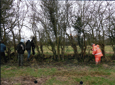
– Hedge laying, Bready; in partnership with the Loughs Agency

– Gates, Slaps and Pillars, Limavady

Liam 1

Liam2

Liam3

Lectures and talks

Were delivered by the project officer at Strabane, Limavady, Derry, Park, Strathfoyle, Dunamanagh, Magilligan and Park.

Exhibition

On the Foyle Landscape Project – Clipper event, July 2012

Closure event

Loughs Agency, 12 April 2013.

Funders

inish copyStrabane DC Logo Derry City CouncilLimavady B C Corporate Logo

HLF Logodard-lang-logo-3


Living City Project

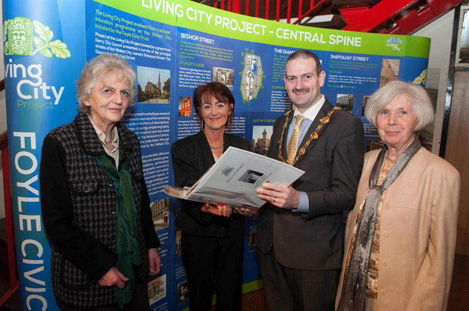
Phase 1 of the Living City Project, funded by a grant from Derry City Council, presented a survey of the principal streets of the Walled City, namely Shipquay Street, The Diamond and Bishop Street.

Phase 2, funded by a grant from the Department of the Environment NIEA, presents a survey of the remaining streets within the city walls in the form of descriptions, historical information, maps, drawings, and photographs, old and new. It includes both historical and new build works including The Playhouse, The Verbal Arts Centre, St Columb’s Cathedral and works undertaken through the Townscape Heritage Initiative by the Walled City Partnership.

This Project provides a valuable reference for anyone carrying out research, in addition to being the only comprehensive record of the Buildings and Streetscape of the Walled City.

Phase 1

Bishop Street
The Diamond
Shipquay Street

Phase 2

Foreword and Overview

North Quadrant

Castle Street
Lower Magazine Street
Union Hall Place
North Quadrant Maps

East Quadrant

Bank Place
East Wall
Ferryquay Street
Linenhall Street
Market Street
Newmarket Street
Richmond Street

East Quadrant Maps

South Quadrant

Artillery Street
Saint Columb’s Cathedral
Church Walls
London Street
Pump Street
St Columb’s Court
South Quadrant Maps

West Quadrant

Butcher Street
Palace Street
Society Street
Stable Lane
Upper Magazine Street
West Quadrant Maps

Walled City partnership

The Walled City Partnership Limited (WCP) comprising the Foyle Civic Trust, Derry City Council and the City Centre Initiative was formed in 2002 with the purpose of preserving and enhancing the architectural and historic character of Derry both within and around the city walls.  The WCP is supported by advisers from Planning NI, North West Development Office and Northern Ireland Housing Executive.  It is responsible for implementing and administering the Walled City Townscape Heritage Initiative.

Townscape Heritage Initiative

The Townscape Heritage Initiative (THI) is a grant aid programme for the restoration and regeneration of the historic built environment in towns and cities throughout the UK. The THI is primarily funded by the Heritage Lottery Fund (HLF).

The primary aim of the THI is to promote the sustainable and viable use of buildings that make up the special architectural character of historic urban areas.

THI gives the highest priority to the restoration of historic buildings and to bringing underused historic properties back into use, particularly those within a designated conservation area.

Phase I THI scheme

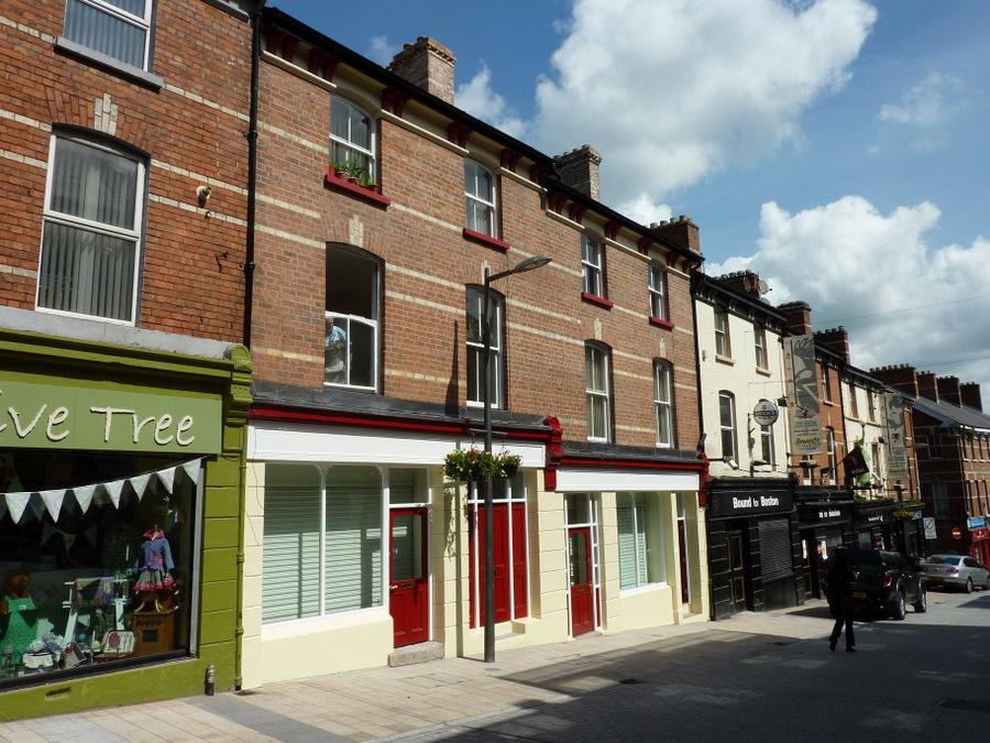
The Phase I THI scheme commenced in 2002 and completed in 2010.  A total of fifteen properties benefited from the scheme, the most prominent of which being the former Northern Counties Hotel in Waterloo Place.

Former Northern Counties Hotel Castle Street / Shipquay Street properties

Castle St - Shipquay St

Former Northern Counties Hotel

The HLF provided a grant of £1 million, which together with partnership funding and owner contributions, resulted in an overall investment in the built heritage of the city centre in the region of £4.5 million.

Phase II THI scheme

In 2010 a further £1.669 million HLF funding was secured which enables the scheme to operate for a further five year period.  The scheme is operating within a defined area of the Historic City Conservation Area, clustering with Phase 1 completions for maximum impact.

Completion of 12-15 Magazine Street    Completion of 23-25 Waterloo Street

12-15 Magazine Street 23-25 Waterloo Street


The Walled City Partnership
The Craft Village
13 Magazine Street
Derry
BT48 6HH
Tel: 02871 371037
Project Officer: Ronan O’Donnell
walledcitypartnership@derrycity.gov.uk

www.walledcitypartnership.com

WCP-Logo

Contact Us

Tel: 028 71371037

Email: foylecivictrust@gmail.com

Registered with The Charity Commission for Northern Ireland NIC100078

Contact

Tel: 028 71371037

Email: foylecivictrust@gmail.com

Registered with The Charity Commission for Northern Ireland NIC100078

Derry City Council LogoFoyle Civic Trust Facebook Page

Copyright © 2025 · Genesis Sample on Genesis Framework · WordPress · Log in